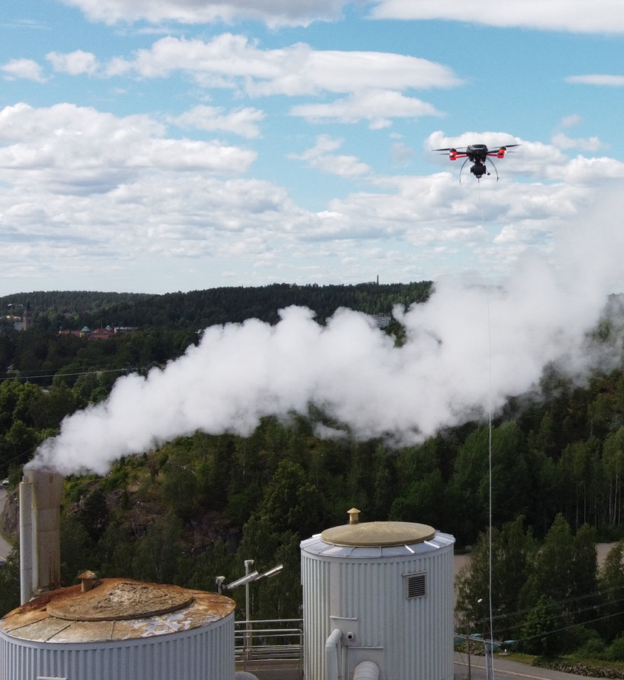
The ultimate bird's-eye view of your emissions
Mapping and quantifying airborne pollutants
Trusted by leading companies in making emissions history
The measurement services we offer have been creating value in various multinational industries since 2014. We have experience in measuring a wide variety of airborne pollutants, our reports helping our clients in progressing with sustainability goals and improving emission reporting according to for example OGMP 2.0 Level 5 and EN17628 requirements.
Read more on how we help various industries.
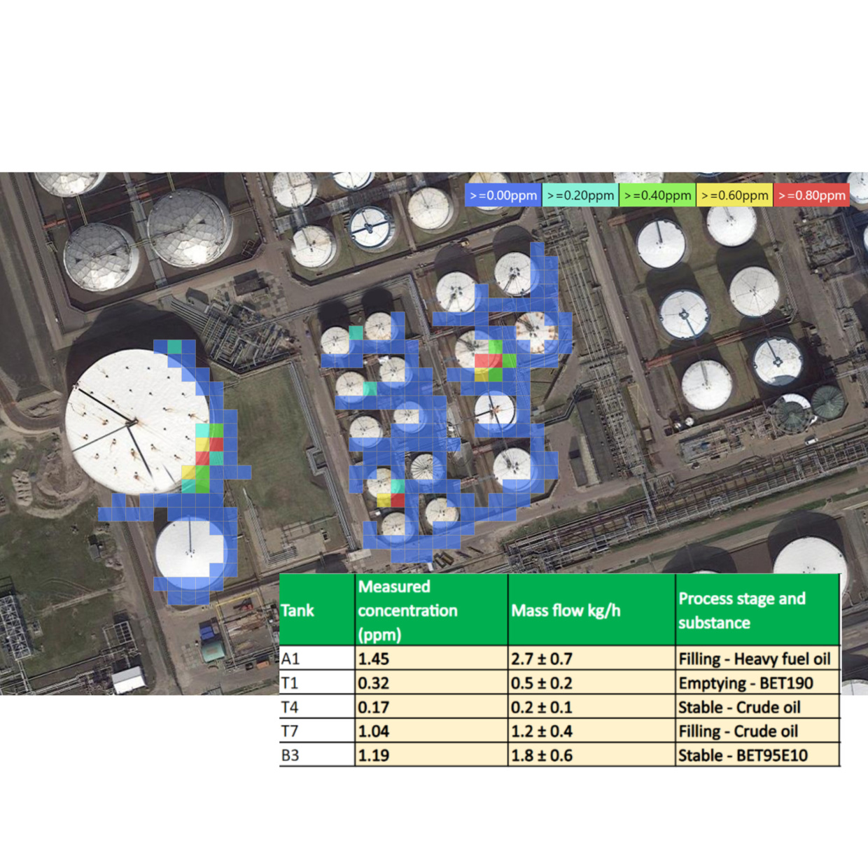
Unrivaled data
Our unique solution gives you:
- Fugitive emission sources and concentration levels
- Leakage locations and volumes
- Layered visualisations of the emission dispersion of various compounds
- Real-Time measurements to support process development and operations
Read more on our reporting and results!
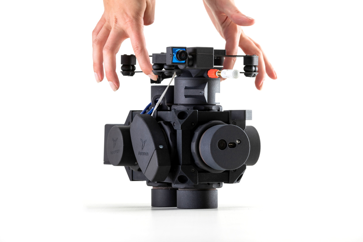
A Swiss army knife of emission monitoring
Our technology can measure thousands of airborne emissions.
Using a modular design, our BH-12 device is capable of measuring multiple pollutants in numerous configurations. The device pumps sample air through a series of attached sensors. Owing to its lightweight design, it is extremely versatile and suitable for use by hand or various device transportation systems. In addition to pollutants, it continuously monitors atmospheric factors and communicates the data in real time to our cloud platform.
Read more about our technology!
Certifications and Accreditations

ISO 9001
Aeromon’s quality management system is certified by Bureau Veritas.
ISO 17025
Aeromon Ltd. is a testing laboratory (No. T362) accredited by FINAS Finnish Accreditation Service, accreditation requirement SFS-EN ISO/IEC 17025. The accreditation is included in the Multilateral Agreement for Accreditation (EA MLA) of the European co-operation for Accreditation (EA). Here you can find answers to commonly asked questions regarding the accreditation.
Taking control of your emissions starts with accurate measurements

Measure
Over a dozen compounds simultaneously

Gather
Emission data efficiently
Visualise
Concentration changes in real-time over a satellite image

Pinpoint
Emission sources
